
Size of this preview: 623 × 599 pixels. Other resolutions: 249 × 240 pixels | 499 × 480 pixels | 798 × 768 pixels | 1,057 × 1,017 pixels.
Original file (1,057 × 1,017 pixels, file size: 567 KB, MIME type: image/jpeg)
Summary
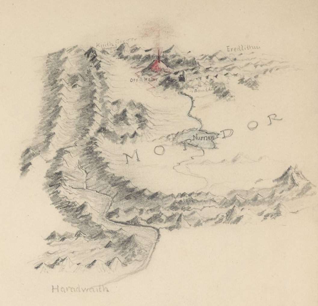
Map of Mordor by J.R.R. Tolkien
”
Bird's eye view of Mordor and Mount Doom, 1940s. This was an early conception of the geography of Mordor. Tolkien altered the relative positions of Barad-dûr and Mount Doom as the story progressed.
Licensing
This work is copyrighted and owned by the Tolkien Estate. It is believed that the limited use of this file,
- on the not-for-profit educational Tolkien Gateway website,
qualifies as fair use under copyright law in the United States of America.
File history
Click on a date/time to view the file as it appeared at that time.
| Date/Time | Thumbnail | Dimensions | User | Comment | |
|---|---|---|---|---|---|
| current | 11:55, 21 October 2025 | | 1,057 × 1,017 (567 KB) | Paccyd33 (talk | contribs) | == Summary == Map of Mordor by J.R.R. Tolkien {{Quote|Bird's eye view of Mordor and Mount Doom, 1940s. This was an early conception of the geography of Mordor. Tolkien altered the relative positions of Barad-dûr and Mount Doom as the story progressed.}} == Licensing == {{Fairuse-Tolkien}} Category:Maps by J.R.R. Tolkien Category:Images of Mordor |
You cannot overwrite this file.
File usage
The following page uses this file: