
Size of this preview: 503 × 600 pixels. Other resolutions: 201 × 240 pixels | 403 × 480 pixels | 644 × 768 pixels | 859 × 1,024 pixels | 2,544 × 3,033 pixels.
Original file (2,544 × 3,033 pixels, file size: 615 KB, MIME type: image/png)
Summary
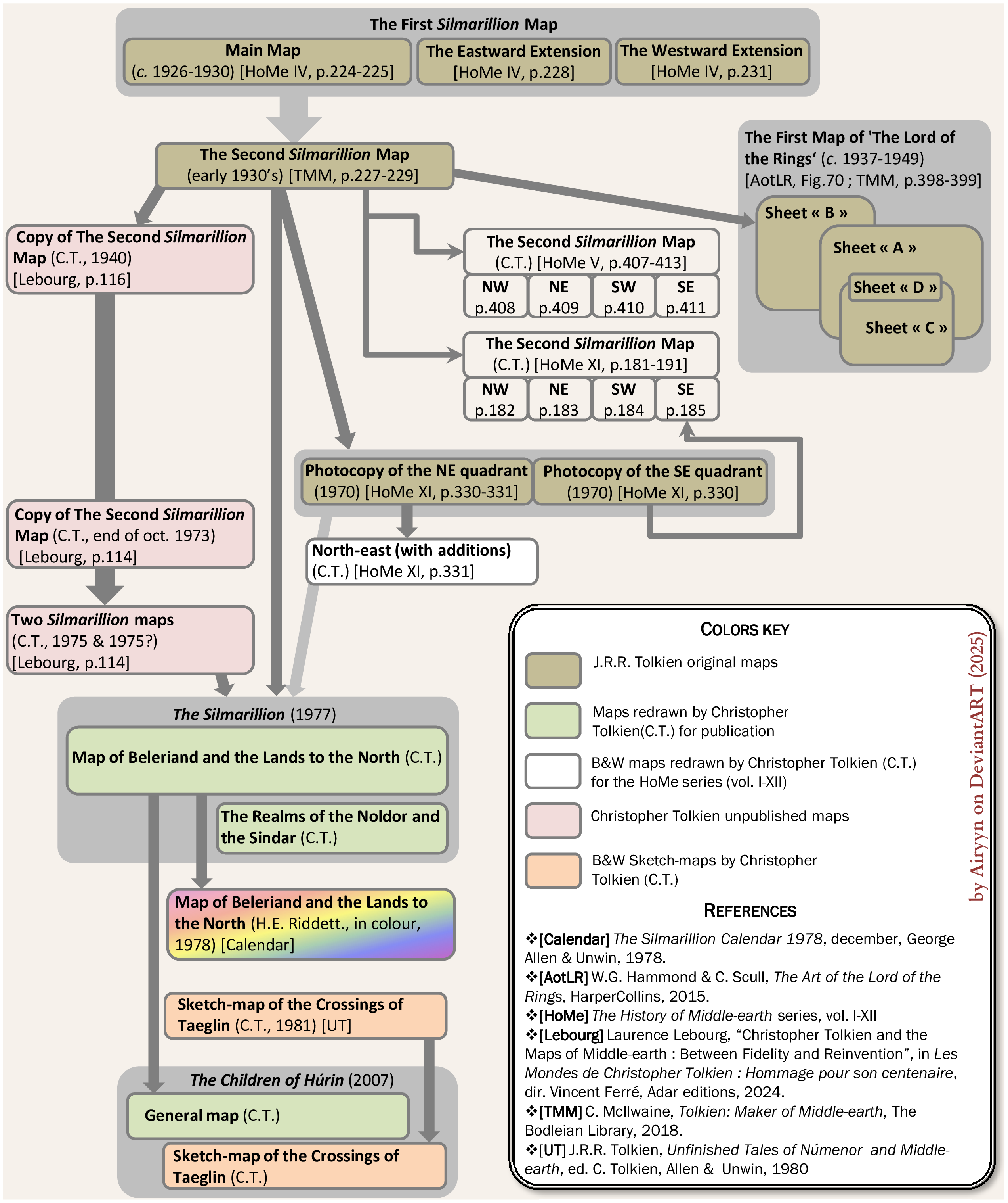
This infographic shows the publishing history of the maps of 'The Silmarillion', from the First Silmarillion map, in 1930's, to the map of the Children of Hurin published in 2007 (Infographic by User:Airyn, october 2025).
Licensing
This work is licensed under the Creative Commons Attribution-ShareAlike 4.0 License.
Attribution: {{{1}}}
File history
Click on a date/time to view the file as it appeared at that time.
| Date/Time | Thumbnail | Dimensions | User | Comment | |
|---|---|---|---|---|---|
| current | 12:04, 5 October 2025 | | 2,544 × 3,033 (615 KB) | Airyn (talk | contribs) | This infographic shows the publishing history of the maps of 'The Silmarillion', from the First Silmarillion map, in 1930's, to the map of the Children of Hurin published in 2007 (Infographic by User:Airyn, october 2025). |
You cannot overwrite this file.
File usage
The following page uses this file: